Table of Contents
equator
Equator is defined as an imaginary line that divides the planet, or any celestial body, into two equal parts, and it is separated between the Arctic and Antarctic, and it is located on a zero-degree circle, and since the Earth has its widest diameter at that line, This, in turn, gives rise to what is known as the equatorial bulge, given that the circumference of the Earth is defined as the distance measured around the Earth at the equator.
The equator receives the largest amount of sunlight, while the regions in the poles of the globe receive less of these rays, which makes them very cold. It is worth noting that the clear difference in the concentration of the distribution of sunlight on the earth is due to the spherical Earth, and its slight inclination around its axis .
Countries where the equator passes
The equator extends up to 40,075 km around the world, and passes only thirteen countries: Sao Tome and Principe, the Republic of the Congo, the Democratic Republic of the Congo, Gabon, Somalia, the Maldives, Uganda, Kenya, Colombia, Brazil, Indonesia, Kiribati, and Ecuador However, the passage of the equator to the Maldives and Kiribati is limited to their water areas without passing through the land areas in them.
The tropics lie roughly in the middle of the globe, specifically between the longitude of the Tropic of Capricorn and the Tropic of Cancer, and include a number of regions: the equator, parts of North America, Asia, Australia, South America, and Africa, where the tropics are warm throughout the year; As the average temperature ranges between 25 and 28 degrees Celsius, in addition to that it does not witness a diversity in seasons; it is dominated only by two seasons: the rainy season, in which the amount of rain varies greatly from one region to another, which directly affects the types of plants and animals That lives there and the other season It is the dry season prevailing in other regions.
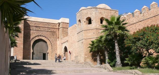
African countries
Sao Tome and Principe
Sao Tome and Principe is located in Central Africa, and according to the Global Positioning System (GPS), it is located on a longitude of 6.613081, and a latitude of 0.186360, within the coordinates of “10.896 ’11 0 ° North,” 47.092 ’36 6 ° E, and the region is dominated by climate It is warm and cloudy throughout the year, as it is characterized by temperatures ranging from 23.89 to 27.78 ° C, and the temperature is rarely less than 22.78 ° C, or more than 28.89 ° C.
Gabon
Gabon is located in Central Africa between Equatorial Guinea and the Republic of the Congo, and borders the Atlantic Ocean at the equator, along the longitude (11.609444) and latitude (-0.803689) within the coordinates of “13.28 ’48 ° 0South,” 33.998’36 ° 11E. And the climate of the Gabonese capital, which is called Libreville, is characterized throughout the year by temperatures ranging from 22.77 to 30.56 ° C, rarely less than 21.67 or raised to 32.22 ° C, and the wet season is characterized by high temperatures accompanied by clouds, while The dry season is partially warm and cloudy, and the rains in the capital continue for 10 months during the M; as of August 17 / August start until June 29.
Republic of the Congo
The Republic of the Congo is located in Central Africa, bordered by Cameroon and the Central African Republic to the north, the Democratic Republic of the Congo to the east, Gabon to the west, and Angola to the southwest, and is located along a longitude (15.827659) and latitude (-0.228021) within the coordinates of 40.876 ’13 0 ° S, and 39.572 ’49 15 ° E.
The temperature in the Republic of the Congo at night ranges between 16 and 21 degrees Celsius, and depending on its location on the equator, the average daily temperature is 24 degrees Celsius, and its climate is generally characterized by humidity. The Republic witnesses rain in the season that begins in the month of October / October and extends to the month of May, but two of the months of this period are accompanied by a short dry season, namely: January, and February, and the Congo also witnesses a dry season that usually lasts from June to September .
Democratic Republic of the Congo
The Democratic Republic of the Congo shares borders with a number of countries. It is bordered by Rwanda, Uganda, Tanzania, Burundi to the east, the Republic of the Congo and the province of Cabinda in Angola to the west, Sudan and the Central African Republic to the north, and Angola and Zambia to the south. The Democratic Republic of the Congo is a country with land borders, as it only has a few kilometers of coasts along the Atlantic Ocean, and its territory extends within two latitudes 5 ° 30 ′ north, and 13 ° 50 south, and a third of its area north of the equator, according to the global positioning system , An audience Of Congo is located along the line (21.758664) and latitude (4.038333-) within the coordinates “17.999 ‘2 ° 4 in the south, and” 31.19 ’45 ° 21 east.
The Democratic Republic of the Congo is distinguished by its diverse climates, as it is divided into four main climatic regions:
- Tropical climate zone: It is characterized by high temperatures, as the average monthly temperature rarely drops to the mid-twenties, and is characterized by high humidity and precipitation throughout the year.
- Atlantic Climate Zone: Limited to the west coast of the country, it has an average annual temperature of the mid-1920s.
- Mountain climate zone: It includes the highlands and eastern high mountains, and the average annual temperature is 18.33 ° C.
- Tropical or subtropical climate zone: It is located in the north and south of the equatorial region, and it is characterized by a dry and rainy season, and the measured distance from the equator affects the period of time that the dry season takes; it may last from four to seven months, usually extending from April to October, while Droughts only last for weeks during the rainy season.
Uganda
Uganda is located in eastern Africa, and Kampala is its capital, and Uganda is devoid of coasts, as it only has land borders with Tanzania, Kenya, Rwanda, South Sudan and the Democratic Republic of the Congo, and it is located along a length of 32.290275, and a latitude of 1.373333 within the coordinates 23.999 ’22 ° 1N, and 24.99’17 ° 32E. Uganda also has a warm climate in general, due to the moderate temperatures and abundant rainfall, where the average annual temperature ranges between 24 and 31 ° C, The annual rainfall ranges between 900 and 1600 mm.
Kenya
The Republic of Kenya is located on the equator, and shares its borders with Uganda, Tanzania, Ethiopia, South Sudan, Somalia, and the Indian Ocean, and is located on the longitude (37.906193), and the latitude (0.023559-) within the coordinates of “24.812 ‘1 ° South, And “22.295 ’54 37 ° E”.
The climate varies in Kenya, where the tropical climate prevails in the areas along the coast, while the dry climate prevails in the interior, and the hot and humid atmosphere prevails in the area surrounding Mombasa city, as the region witnesses a rise in temperature, in January, And the month of February, when the temperature reaches 31 degrees Celsius, while it reaches 27 degrees Celsius in the months from July to September, as the cold weather prevails in them.
Somalia
Somalia is one of the countries of the Horn of Africa, it is located in the far east of Africa, and extends from the south of the equator towards the north to reach the Gulf of Aden. It is worth noting that Somalia occupies an important geographical and political position between the countries of the Arabian Peninsula, southwest Asia, and sub-Saharan Africa, which is located At longitude 46.199616, and latitude 5.152149 within the coordinates of “7.736 ‘9 ° 5N,” and “58.618” 11 ° 46E.
Somalia’s climate is characterized by a hot climate throughout the year, and it is accompanied by monsoons, irregular periods of precipitation, and hot and humid weather prevails during the periods of monsoons, during the months of October and November, as well as in the extended period From March to May, due to the intense temperature rise that occurs during these months, it is known as Tangambili (Somali: Tangambili).
The average daily maximum temperatures in Somalia range between 30 and 40 degrees Celsius, except in areas along the eastern coast and high regions, while the average daily minimum temperatures range from 15 to 30 degrees Celsius, and temperatures in southern Somalia are less severe In coastal areas, the temperature varies by five to ten degrees less than its value in the interior regions, which makes the coastal regions cooler, and the coastal regions maintain a relative humidity that usually reaches about 70%, even during dry seasons that spread periodically in Somalia.
As for the climate prevailing in Mogadishu in particular, it is rarely pleasant, although the season is more moderate in the period from May to October, and this is due to the sea breeze and the southwest monsoon. When the northeast monsoon blows relatively moderately in the period from October to February.
South American continent countries
Ecuador
Ecuador, located on the continent of South America, has a common border with Colombia in the north, Peru in the east and south, and the Pacific in the west, and is located along a longitude (- 78.183406), and a latitude (-1.8831239) within the coordinates of “52.46 ’49 ° 1 south, and“ 0.262 ” 11 78 ° W
Frost can sweep highland areas in Ecuador during clear and cloudless nights in the dry season, and peaks with a height of more than 4998.72m are covered with snow, and the humid and tropical climate prevails in most of Ecuador’s regions; this is due to their occurrence on the equator, while climates prevail, The temperate zone is located in areas between 792.48 and 2011.68 m. The Costa region is affected by an antenna called the Peruvian cold current, as well as by significant changes related to the movement of the orbital convergence region.
Warm weather prevails in the coastal and eastern regions, accompanied by a slight difference in temperatures throughout the year, while temperatures vary more between night and day, with average daytime temperatures ranging from 28.89 to 32.78 ° C, while at night between 20 and 23. 89 ° C, and temperatures drop at a rate ranging from 12.78 to 11.67 ° C as the increase increases by 1,005.84 m.
Colombia
Colombia is located in South America, specifically in the northwestern region, and it shares borders with a number of countries; it is bordered by Ecuador and Peru to the south, Brazil and Venezuela to the east, Panama and the Pacific Ocean to the west, and the Atlantic Ocean across the Caribbean Sea to the north, and it is located on a line Length (-74.297333), and latitude (4.570868) within the coordinates of “15.125 ’34 ° 4N,” “50.399’17” 74W.
The hot climate prevails in Colombia, especially in the low-lying areas, especially the eastern ones, and this is due to its proximity to the equator, and the temperature is affected significantly as the height of the region increases, as it decreases by two degrees Celsius whenever the rise increases by 300 m above sea level, And rain falls in Colombia in different quantities according to the location of the region, where the southern regions witness more precipitation than in other regions.
Brazil
Depending on the global positioning system, Brazil is located along a longitude (-51.925280), and a latitude (-14.235004) within the coordinates of “6.014’14 ° 14’S, and” 31.008’55 ° 51’W, and geographically bounded on the north by Venezuela and Guyana , Suriname, French Guiana, to the south of Uruguay, to the southwest by Paraguay and Argentina, to the west by Bolivia and Peru, to the northwest by Colombia, and to the east by the Atlantic Ocean, as it is indicated that Brazil has a coast of 7,367 km.
There are temperate regions in Brazil although it is a tropical country, where the hot tropical climate generally prevails in the Amazon basin, and Brazil is witnessing rain in the period from October to May, where the rains are heavy in the upper Amazon basin , And in the lowlands, along the northern coast, and in certain regions of the east coast, and in the interior of southern Brazil, with an annual average rainfall of more than 300 cm in some areas, while the north-eastern regions of Brazil are subject to drought periodically.
Brazil is experiencing the largest drop in temperatures in the period from May to September, where the atmosphere is very cold, and snow may sometimes fall on the plains of the cold highlands in the south, while temperatures witness the largest increase in the period from a month From October to March, a very hot climate prevails in Brazil, and it is noteworthy that the average high temperature in Rio de Janeiro reaches 29 degrees in February, while the average minimum temperature in it reaches 17 ° C.
The terrain is multiple in Brazil, which includes: the Brazilian highlands, narrow coastal lowlands, and plains of moderate altitude climates, it is worth noting that the Brazilian highlands constitute about half of the total area of Brazil, and they are classified as semi-tropical, while the divisions of narrow coastal lowlands are diversified, as they fall The areas of the northern lands are within the tropics, while the southern lands are within the temperate regions.
Island countries between the Indian Ocean and the Pacific Ocean
the moldive Islands
The Maldives is located on the equator in the central north of the Indian Ocean, and is considered an independent island country. It is astronomically located on the longitude of 73.220680, and a latitude of 3.202778 within the coordinates of “10.001” 12 ° 3N, and “14.448” 13 73 ° E.
The Maldives is affected by a seasonal climate consisting of two different seasons, due to their occurrence on the equator. The northeast monsoon blows in the period from January to March during the dry season, while the Maldives is affected by the southwest monsoon. During the wet season, temperatures rarely differ in these two seasons, which means that the Maldives remain within the same temperature almost throughout the year, but they differ at night from daytime, ranging from 31 ° C during the day to 23 ° C at night to be pleasant And mild in the evening, Accompanied by cold sea breezes even in hot days; due to the nature island, and being surrounded by the sea.
Temperature monitoring indicates that the highest temperature recorded in the Maldives was 36.8 ° C, which was recorded in the Kadhdhoo Meteorological Office, on May 19, 1991, while the National Meteorological Center registered In the eleventh of the month of April of 1978 AD the lowest temperature reached by the Maldives, which is 17.2 degrees Celsius.
Kiribati
Kiribati is an island located in the tropical equatorial Pacific, and it consists of thirty-three atolls spread over an area of 3,500,000 km 2 near the equator, and it is located along a longitude (-157.363026), and a latitude (1.870883) within the coordinates of “15.179 ’52 ° 1” North, and 46.894 ’21 157 ° W.
The climate is hot and humid in Kiribati, where the tropical marine climate prevails in it, and hurricanes can be experienced at any time, but they often occur in the period from November to March, and the average daily temperature in Kiribati 28 degrees Celsius, which are tempered by the trade winds, given that the average temperature is relatively constant throughout the year, in addition to the air temperature in Kiribati that is greatly affected by the temperature of the ocean surrounding the atolls and small islands.
The nature of the climate prevailing in Kiribati is similar to that prevailing across the tropical Pacific Ocean, which in turn affects the climate throughout the world. The climate of Kiribati varies greatly from year to year; this is due to the southern fluctuation known as the El Niño phenomenon, while the change in The temperature from one season to another during the same year is considered very simple, not exceeding one degree Celsius.
Indonesia
Indonesia is an archipelago of a number of 18,108 islands, where the number of inhabited islands is approximately seven thousand, and Indonesia is located opposite the coast of Southeast Asia in the Indian Ocean and the Pacific, and it extends for a distance equivalent to one eighth of the Earth’s circumference. Longitude (113.921327), and latitude (-0.7789275) within the coordinates of “21.39 ’47 ° 0 S, and” 16.777 ’55 ° 113 E ‘.
The tropical climate prevails in Indonesia, due to its proximity to the equator, as temperatures vary according to the difference in the nature of the country, which includes the plains and mountains, so the average temperature in the coastal plains reaches 28 degrees Celsius, and it decreases by 5 degrees in the upper mountain areas, The percentage of humidity also differs from one city to another in Indonesia, where humidity reaches the highest percentage in the interior regions of Clementan, West New Guinea, West Sumatra, Java, Bali, and Sulawesi, and with a rainfall of more than 2,000 mm annually, and the city of Bogor is Near Jakarta, the most regions of the world Satisfaction of rain storms every year, where 322 is exposed to the storm.
Tropical climate properties
It is widely believed that the tropical regions are the hottest regions of the world due to their occurrence on the equator, which makes them receive the most amount of sunlight throughout the year, while it turns out from the fact that the hottest regions in the world lie above and below the equator, that is, Tropics: The reason for this is that the temperature of humid air differs from that of dry air. Sunlight falling on the equator generates rising air currents that contribute to the formation of clouds over the tropics, which leads to precipitation, thunderstorms, and hence lower degrees of temperature. Heat in Areas located on the equator.