Table of Contents
Failaka Island
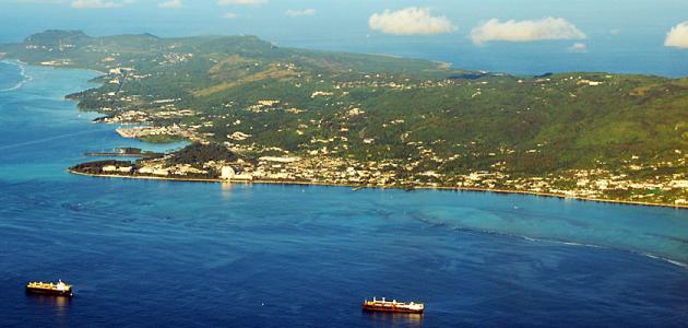
It is located in Kuwait, specifically on the northern side, so that it is about twenty kilometers from the capital, and its length is about twelve kilometers, while its width is six kilometers, and its total area is estimated at forty-three kilometers, and its largest elevation is about ten meters, the length of its strip Coastal does not exceed thirty-eight kilometers.
The importance of Failaka Island
The island was for great times an important commercial station, because it was located on the sea route linking Mesopotamia, and it also had a great religious status and importance, especially in ancient times, in addition to being the first to establish the first urban centers that existed in the Arabian Gulf region, As for its name, according to historians, it is derived from a Greek word called Velakio, which means a central point or a far place.
Geography of Failaka Island
It owns clay soil suitable for cultivation, and it was known until the middle of the previous century for cultivating different varieties of crops, most notably corn and wheat in addition to alfalfa, and many vegetables, especially leafy, and luckiest were melons and melons, and the other part of the part was dominated by soil mixed with marine sediments, either in the western region From the island, specifically the coastal region, the soil is salty, and by moving to the northwestern side, the soil is less salty and more sandy, and the marsh land is in the middle of the island.
As for the rocks, they will be freely and spread throughout most of the north, south, east and north of the island, in addition to the roughly grained sandy soil, which helped meet the nutritional needs of the population is the nature of its arable land, and includes a group of hills of different height despite not exceeding a few feet, and was completed Discovering a group of temples in it, most notably Tel Saad and Saeed, in addition to a lack of knowledge and a lack of palaces, and a few is a Kuwaiti word meaning a hill.
Failaka Island island villages
- Happy village: It is located on the northwestern side of the island, and it has a very large coast, and it included the most important ports of the island, and this allowed to communicate with Iraq and Iran in a better way, and found foundations for a mosque, and near it the shrine of the Greens is a place of importance for the residents of the village, and it was removed In the seventies of the previous century.
- Al-Dasht Village: It is located in the north-eastern side of Said village, and it contained a large mosque.
- Al-Qurainia Village: It is located in an elevated area overlooking the sea and the plain, and was used as a port for ships used to transport fishermen and pearls.
- Morning village: It was known to spread fresh water wells in it in addition to palm trees.
- Palaces area: It is located in the middle of the island, and includes twelve archaeological sites, the most important of which is a church dating back to a period that predates the prophetic mission by nearly a hundred years.
- Al-Zour village: It was abandoned in the aftermath of the second Gulf War, as a result of the spread of the plague disease in it, which encouraged many to stay in its location and waters suitable for fishing, in addition to the spread of fresh wells in it.

