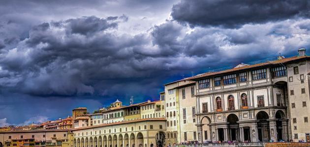
Tourism in America is one of the dreams that many people of different nationalities want, because of the diversity of its tourism components and then the diversity of the natures of tourist tours to it. The country’s history since its inception, as well as the high standard of living and the prowess of technological progress in everything.
So we will be your guide on your travel and answer all your questions about where America is located, how to get a travel visa to it and the distances between the most important cities in it.

Table of Contents
- The best of America hotels
- Where is America located on the map?
- How to travel to America
- Where is America located and the distances between the most important cities of America?
- Where is New York from Los Angeles?
- The distance between Chicago and Houston
- Where is Philadelphia from Phoenix
- Where is San Antonio located from San Diego
- Where is Dallas from San Jose?
- The distance between Detroit and Indianapolis
- Where is San Francisco from Jacksonville
The best of America hotels
America includes thousands of high-end hotels and resorts world-famous, so that it has the most famous chains whose branches are spread all over the earth, and therefore there is no analogy to the luxury, sophistication and joy of residence offered by American hotels in other countries, so visitors always praise them and occupy the highest ranks of evaluation, and while Next, we will display a list of the best hotels in America, according to the opinions and opinions of Arab visitors .. Read more
Where is America located on the map?
America is located in the continent of North America, bordered to the west by the Pacific Ocean, to the east by the Atlantic Ocean, and bounded to the north by the State of Canada, and to the south by the State of Mexico. Below we will display the map of America and where America is located specifically on Google Maps:
How to travel to America
American entry visas vary for temporary residence visas and permanent residency visas. Included under the type of temporary residence are entry visas for the purpose of visiting, tourism, attending meetings, signing contracts … etc. Types of time jobs, knowing that it is symbolized for temporary residence for the purpose of working with B-1 and its duration is six months is Extendable, as for tourism, it takes the code B-2, with a duration of six months, which is renewable after giving good reasons and attaching the required documents.
Where is America located and the distances between the most important cities of America?
After we got to know where America is located, we will learn below the most important cities in America and the distances and travel routes between the different cities of America, according to Google Maps estimates in kilometers.
Where is New York from Los Angeles?
New York is 4,490 km from Los Angeles, which equates to a 41-hour drive along the I-80 E track.
While the distance between the two cities is estimated at 5 hours by flying via Spirit Airlines, JetBlue Airways, United Airlines, which provides 37 to 53 flights per day non-stop.
The distance between Chicago and Houston
Chicago is 1,741 km away from Houston and is equivalent to 16 hours’ 31-minute drive across I-57 N
While the distance between the two cities is estimated at 2 hours 20 minutes by flying through Spirit Airlines, American Airlines, United Airlines, which provides 22 to 23 flights per day non-stop.
Where is Philadelphia from Phoenix
Philadelphia is 342 km from Phoenix, equivalent to 5 hours 30 minutes’ drive.
While the distance between the two cities is estimated at 1 hour 10 minutes by flying via American Airlines, Jet Airways, Delta Air Lines, which provides 4 to 5 flights per day non-stop.
Where is San Antonio located from San Diego
San Antonio is 2,051 km from San Diego, equivalent to an 18-hour 30-minute drive. The following map shows the route.
The distance between the two cities is estimated at 2 hours 35 minutes by flying via American Airlines Frontier Airlines, United Airlines, which provides 2 to 3 flights per day non-stop.
Where is Dallas from San Jose?
Dallas is 2.71 km from San Jose, equivalent to 26 hours’ drive, while the cities between the two cities are estimated to be 3 hours 20 minutes flying by United Airlines, Alaska Airlines, which provides 12 to 17 flights per day non-stop. .
The distance between Detroit and Indianapolis
Detroit is away from Indianapolis 462 km and is equivalent to driving 4 hours 29 minutes along I-69 N and US-24 E
While the distance between the cities of Detroit and Indianapolis is estimated at 1 hour 5 minutes by flying via Delta Air Lines American Airlines, which provides 4 to 7 flights per day non-stop.
Where is San Francisco from Jacksonville
San Francisco is 4,499 km from Jacksonville and is the equivalent of 40 hours’ driving across the fastest route shown on the map.
While the distance between the cities of Francisco from Jacksonville is estimated at 7 hours 30 minutes, flying through United Airlines, American Airlines and JetBlue Airways one or more stops.
If you still have some questions and inquiries about where is America located or how to travel to it? You can write your inquiry in the comments box below to answer it as soon as possible, and to find out the most beautiful places of tourism in America, you can follow us on our website by looking at this tab .. Read more


