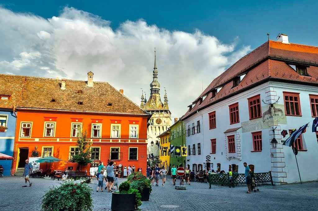
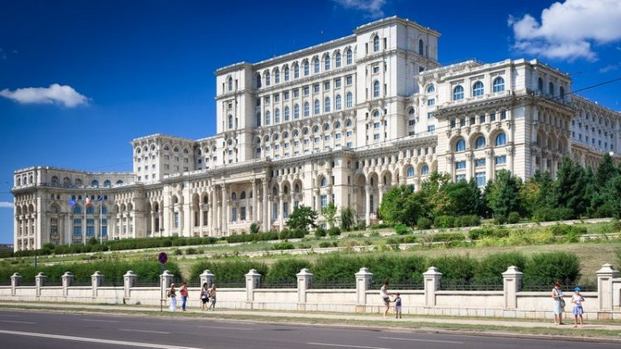
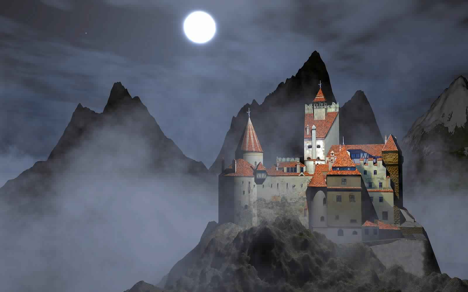
Tourism in Romenia is one of the most beautiful travel activities that can be enjoyed, due to the fact that it is one of the most beautiful destinations in Eastern Europe, because it has a charming nature, where mountains, forests, plains and rivers mix in a wonderful mix, in addition to the ancient monuments such as the old town, Pelic Castle and Palace of Parliament Romen and Bran Castle, as well as museums and art galleries.
So we will be your guide on your trip and answer all your questions about where Romenia is located, how to obtain a travel visa to it and the distances between the most important cities in it.

Table of Contents
- Romenia’s best hotels
- Where is Romenia located on the world map?
- How to travel to Romenia
- The distance between the most important cities of Romenia
- Where is Timisoara located from Yash?
- The distance between Constanساa and Craiova
- Where is Bucharest from Cluj-Napoca?
- Where is Ploieشتth from Oradea?
- The distance between Braila and Arad
- The distance between Piteشتti and Sibiu
- Where is Bacau located in Targu Muresh?
- The distance between Baia Mare and Potoshani
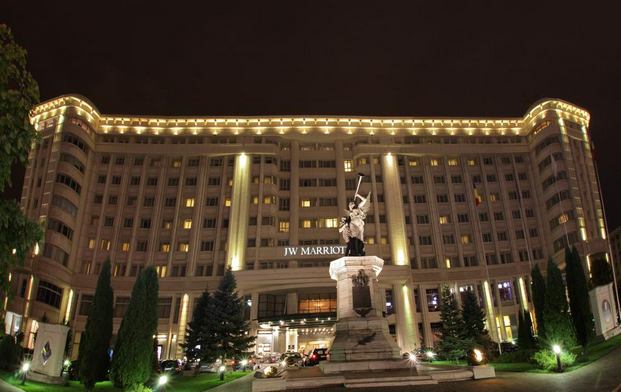
Romenia’s best hotels
In Romenia hotels, the global patterns of the most famous and finest chains, as well as authentic Romen hotels that stick to the character of the old country and local cuisine, and both types constantly capture the satisfaction and approval of Arab visitors, and below we will display a list of the best hotels in Romenia, according to the reviews and opinions of Arab visitors .. Read more

Where is Romenia located on the world map?
Romenia is located in the eastern European, specifically in the north of the Balkan countries, bordered to the north by the states of Ukraine and Moldova, to the east by the Black Sea, and to the south by Bulgaria, and by the western border by Serbia and Hungary. Below we will display the map of Romenia and where Romenia is located specifically on Google Maps:
How to travel to Romenia
The tourist visa to Romenia is divided into the same single visit and multiple visits, both of which allow residence in the country for a period of 30 days only, but the first type is canceled immediately upon leaving the country, and the second allows exit and entry into the country according to the desire during the month granted.
The distance between the most important cities of Romenia
After we got to know where Romenia is located, we will learn below the where the most important and most important cities in Romenia are located, how to travel and ways to travel between Romenian cities and their members, and calculate the distance in kilometers according to Google Maps estimates.
Where is Timisoara located from Yash?
The distance between Timiوارoara and Yash is 9 hours 52 minutes, which is 634 km when traveling by car via the A1 route.
The distance between them is 1 hour 50 minutes by flying via Tarom Lufthansa Airlines, Austrian Airlines, with an average of 3 flights per week non-stop.
The distance between Constanساa and Craiova
The distance between Constanta and Craiova is 5 hours 21 minutes, which is equivalent to 459 km by car via the E81 track.
The distance between them is estimated at 9 hours 44 minutes by bus.
While the distance between the two cities is 3 hours 50 minutes by flying via Tarom Airlines, Turkish Airlines, Austrian Airlines, one or more stops.
Where is Bucharest from Cluj-Napoca?
The distance between Bucharest and Cluj-Napoca is 449 km, which is 6 hours 13 minutes’ drive via the E81.
While the distance between the two cities is 45 minutes by flying via LOT Polish Airlines, Lot Airways, which provides 4 to 7 non-stop daily flights.
Where is Ploieشتth from Oradea?
The distance between Ploieشتde and Oradea is 536 km, which equates to 7 hours 46 minutes’ drive travel via the DN13 / E60 and DN1 / E60 track.
The distance between the two cities by plane is estimated at a time of one hour via Tarom Airlines, which provides 3 non-stop flights daily.
The distance between Braila and Arad
The distance between Braila and Arad is approximately 708 km, which is equivalent to 9 hours 57 minutes’ drive via A1.
While the distance between them is estimated at 10 hours and 1 minute, which is equivalent to 806 km by car via the A1 and DN1 / E68 tracks.
The distance between Piteشتti and Sibiu
The distance between Piteشتti and Sibiu is 161 km, equal to 2 hours’ 44-hour drive via the DN7 / E81.
Where is Bacau located in Targu Muresh?
Bacau is 251 km from Târgu Muresh, equal to 4 hours 21 minutes’ drive travel via the DN15 track.
While the distance between the two cities is estimated at 290 km, which equals 4 hours 56 minutes drive travel via the DN15 / E578 and DN15 track.
The distance between Baia Mare and Potoshani
Baia Mare is 337 km from Botohani, which equates to 6-hour drive by car via the DN17 / E58 and DN18 track.
While the distance between the two cities by plane is estimated at a time of 3 hours 45 minutes via Austrian Airlines Lufthansa Tarom one or more stops.
If you still have some questions and inquiries about where is Romenia located or how to travel to it? You can write your inquiry in the comments box below to answer it as soon as possible, and to find out the most beautiful places of tourism in Romenia you can follow us on our website